Weather woes- Heavy rain in Kyushu Japan

What cause the flood?
When did this occur?
Where are the areas affected?
Who are the ones affected most?
Why are floods a hazard?
How can flood be mitigated?

http://www.youtube.com/watch?v=h20NGt6_dmQ&feature=share&list=PLD35278076538AA4E
The impact of heavy rain in Kyushu, Japan:
About 400,000 people were ordered or advised to leave their homes in southwest Japan  Sat 14 July as heavy rain pounded the area for a third day leaving 29 dead or missing.
In Fukuoka prefecture alone, 78,600 people were ordered to evacuate their homes as rivers overflowed in dozens of places and 181 landslides occurred. About 820 houses were damaged and three bridges washed away.


http://www.mmail.com.my/image/typhoon

What brings about the heavy rain as shown on the map?
Why does typhoon frequently hit Japan as shown on the map?

Read Users' Comments (0)

Singapore to raise reclaimed land level


What would happen to our coastal land  as sea level around Singapore is predicted to rise between 24 and 65 centimetres by 2100?

How can we battle against climate change?

About 70 per cent of the coast line is already protected by hard structures like sea walls or stone embankments, which help protect against coastal erosion. Do you think they will be effective in protecting the coast in the long term?

"Geo bags"  had been added to one eroded stretch of the beach, near the Road Safety Park. Geo bags are a type of sandbag made of a special sticky material that sand can adhere to. Apart from successfully building up beach two years on since 2010, the sandy surface of the bags also help them blend naturally into the beach front. How effectively do you think this will be against coastal erosion?

Read Users' Comments (0)

China one-child policy


Do you think China's one-child policy is effective in controlling the population?
What are the problems which China is facing due to the introduction of one-child policy?
What are the exceptions to the one-child policy as mentioned by the news article?


Read Users' Comments (0)

Singapore birth rate 3rd lowest in 5 East Asia nations


Though the figures from the National Population and Talent Division revealed figures that Singapore's total fertility rate had increased to 1.2 last year from 2010's record low of 1.5, our fertility rate is low behind the replacement level.

The 5 countries shown above are facing the same challenge of low fertility rates. Later marriages, rising single-hood and fewer children are some of the major reasons for the low fertility rates. These could be due to higher level of education attainment and better employment opportunities.

Among the 5 nations, Japan's fertility rate has rose to 1.32 in 2006 and continued to rise. This could be due to Japan's social support system makes it less of a struggle for parents to raise children. Japan also has a national pension system "which takes care of long term social security". To encourage Singaporeans to marry earlier and procreate, housing could be cheaper, education less expensive and stressful and childcare options more affordable.

As mentioned by Deputy Prime Minister and Minster for Home Affairs Teo Chee Hean yesterday that creating a supportive envrionment for Singaporeans to form families and raise children has been, and remains, a key government priority in addressing the population challenge.

extracted from http://epaper.mypaper.sg/emnd/fvxen/fvxp/fvxpress.php?param=2012-06-29

Do you have any suggestions of ways to increase our fertility rate?


Read Users' Comments (0)

Garden by the bay - a new tourist attraction?


 Do you think this will be a new tourist attraction?

Read Users' Comments (0)

Field Inquiry on Tourism

The first field inquiry on human geography which we have learned to be more open minded. We have also learned from each other the need to check whether the data collected is skewed.  We did a land use transact and learned to see the pattern e.g goods are sold mainly on the 1st level and services on the 2nd level, higher order goods such as electronics and jewllery shops are found along Pagoda street, Temple street and Trengganu Street which catered more to the tourists as compared to Sago street where there are. more pastry shops as it is nearer to the Kretar Ayer CC where more locals actually shop.  . However there is pastry shop along Sago. For almost all the tourists whom we interviewed, most are attracted by shopping as well as the temples nearby.

As Geographers, we need to look at the spatial distribution of the land use.  There is also a need to see the spatial patterns for Human Geography during post fieldtrip when collecting data.

Interesting findings of the different streets. Smith Street - food vendors of local delicacies but more expensive - a deliberate planning by STB to introduce the local food of the 60s. However almost all the stalls are not opened in the morning. It would be more appropriate to do the survey for this stretch of road in the evening. There are also more restaurants that are cosmopolitan e.g. Thai etc. there. We found out that many tourists would actually go for food that they are more familiar with as compared to trying the local food. There are a lot of accommodation such as hostel and budget hotels along Mosque street -most tourist book online and stayed there as it is relatively cheap. Here we could look at how amenities affect tourism. Most of them stayed there due to the availability of public transport such as MRT and public buses nearby. They have booked the stay online and most would have sourced the accommodation and nearby attractions on the internet. Thus we could also see how accessibility in terms of transport and information can attract tourists.


Read Users' Comments (0)

Field inquiry on coastal studies

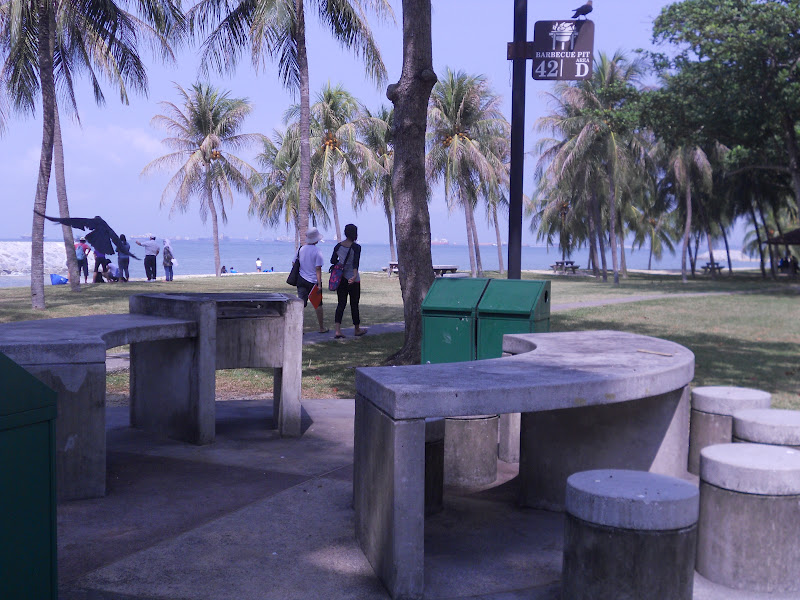
Our first activity at the East coast park was to label the low water mark, the high water mark, the shoreline and the coastline.


We then proceeded to our assigned area, cell G. The breakers here are higher and nearer to each other. We observed the symmetrical shape of the coastline so we came up with the hypothesis that the beach gradient should also be the same on both sides behind the breakers. However, after measuring the gradient, we realised that the gradient is steepest at the one on the West compared to the one facing the East. We suspected that the more gentle slope could be a results of the longshore drift. We threw an apple into the sea and the swash brought the apple up the shore and the backwash brought it back to the sea causing the apple to move from west to east. However, it took a long time for the apple to move eastwards. We also timed the no. of waves per min  - 20 per min which showed that the waves are strong and destructive. Thus the breakwater was quite effective - the coast which is actually reclaimed land would have given way to erosion if the coastal protection was not introduced. 


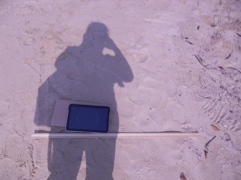
Using the downloaded application clinometer, we measured the gradient at every 1m interval from the high water mark with the tablet. Amazing what technology can do as in the past we have to carry the ranging poles and the clinometer to measure the beach gradient in order to plot the beach profile. When I downloaded the free app clinometer and smart compass from the Android Market , I also saw the 3D earthquake app which was so amazing - the next good app after google map!


The sketch which I did at the area we were assigned.


 The East Coast Park is bustling with activities and can be very crowded during the weekends. Luckily we are there on a weekday. We show people camping, jogging, cycling and a group of students who are ready to start their BBQ. We did interviews with the people and learned quite a bit.


This was our findings which we presented at the post fieldwork session.

Read Users' Comments (0)

Field inquiry on Weather Studies


We started off the activity with "human thermometer" for the five different sites.
Rating based on our senses without the instruments

Measuring of humidity is tedious with the sling psychrometer as we have to swing the instrument with 2 swings per sec which is like 120 round per min!


Sling Psychrometer - to measure humidity

Using the weather tracker, we compared the readings and tested our hypothesis on how the temperature was affected by the amount of shade and concrete surface area. Some areas are more exposed and floored with cement such as the parade square which resulted in the highest temperature recorded. In the areas which are more shaded and with soil such as the garden recorded the lowest temperatures.

I prefer to use this weather tracker which shows the humidity, temperature and wind speed - less tedious.


Read Users' Comments (0)

Singapore ranks 4th most popular destination by air

Why do you think Singapore is able to achieve such a high ranking?
Why do you think development of tourism in Singapore is so important?
Why do you think the largest number of tourists to Singapore is from Jakarta?
Why do you think the tourists from London spend the most amount of money in Singapore?
What are the factors which have encouraged the growth of tourism globally?

Read Users' Comments (0)

World Population

Population Growth
Log onto http://www.worldometers.info/  and see how fast the counter moves. 
How long do you think it will take world population to reach 10 billion (10 000 000 000)?
Look at the net population growth (births minus deaths) and do your maths!


Refer to the population of the different countries in 2011 - China top the list followed by India.  However if you look at the land area compared with the population - which country has the highest population density? 
Population Density = Population divided by the land area

Read Users' Comments (0)